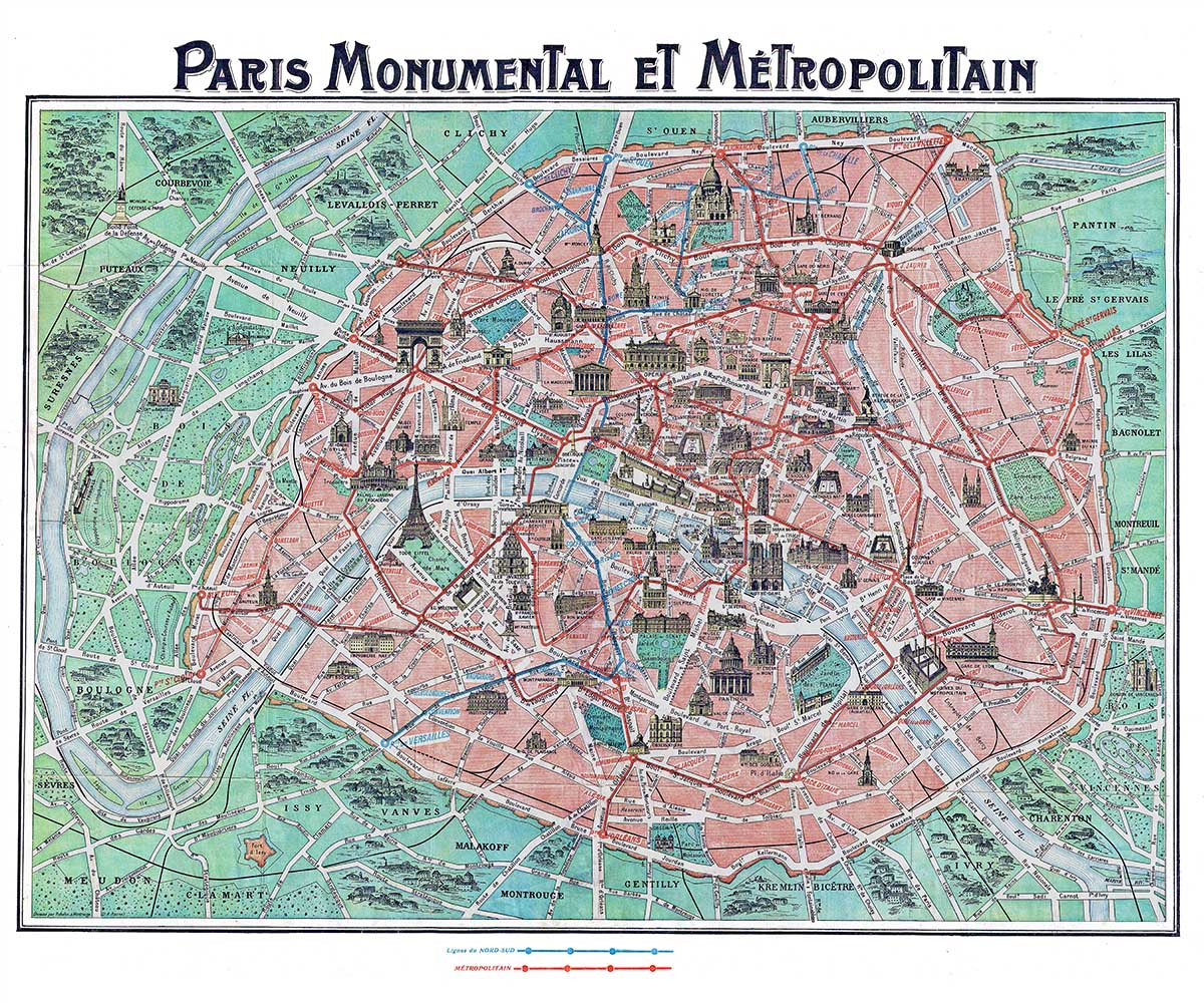
Paris Monumental Et Metropolitain

Paris Monumental et Metropolitain
Paris, France – Vintage map. This is an extremely attractive c. 1932 tourist pocket map of Paris, France. Covers the old walled city of Paris and the immediate vicinity. Important buildings are shown in profile, including the Eiffel Tower. Shows both the train and Metro lines throughout the city. Though undated we can assign an approximate date due to the development of the subway system and the map’s overall style and construction. The map was attached to the original red paper booklet. Prepared by Robelin.
Paris is located in northern central France. By road it is 450 kilometres (280 mi) southeast of London, 287 kilometres (178 mi) south of Calais, 305 kilometres (190 mi) southwest of Brussels, 774 kilometres (481 mi) north of Marseille, 385 kilometres (239 mi) northeast of Nantes, and 135 kilometres (84 mi) southeast of Rouen. Paris is located in the north-bending arc of the river Seine and includes two islands, the Île Saint-Louis and the larger Île de la Cité, which form the oldest part of the city.
The river’s mouth on the English Channel (La Manche) is about 233 mi (375 km) downstream of the city, established around 7600 BC. The city is spread widely on both banks of the river. Overall, the city is relatively flat, and the lowest point is 35 m (115 ft) above sea level. Paris has several prominent hills, the highest of which is Montmartre at 130 m (427 ft). Montmartre gained its name from the martyrdom of Saint Denis, first bishop of Paris, atop the Mons Martyrum, “Martyr’s mound”, in 250.
Excluding the outlying parks of Bois de Boulogne and Bois de Vincennes, Paris covers an oval measuring about 87 km2 (34 sq mi) in area, enclosed by the 35 km (22 mi) ring road, the Boulevard Périphérique. The city’s last major annexation of outlying territories in 1860 not only gave it its modern form but also created the 20 clockwise-spiralling arrondissements (municipal boroughs). From the 1860 area of 78 km2 (30 sq mi), the city limits were expanded marginally to 86.9 km2 (33.6 sq mi) in the 1920s. In 1929, the Bois de Boulogne and Bois de Vincennes forest parks were officially annexed to the city, bringing its area to about 105 km2 (41 sq mi). The metropolitan area of the city is 2,300 km2 (890 sq mi).